
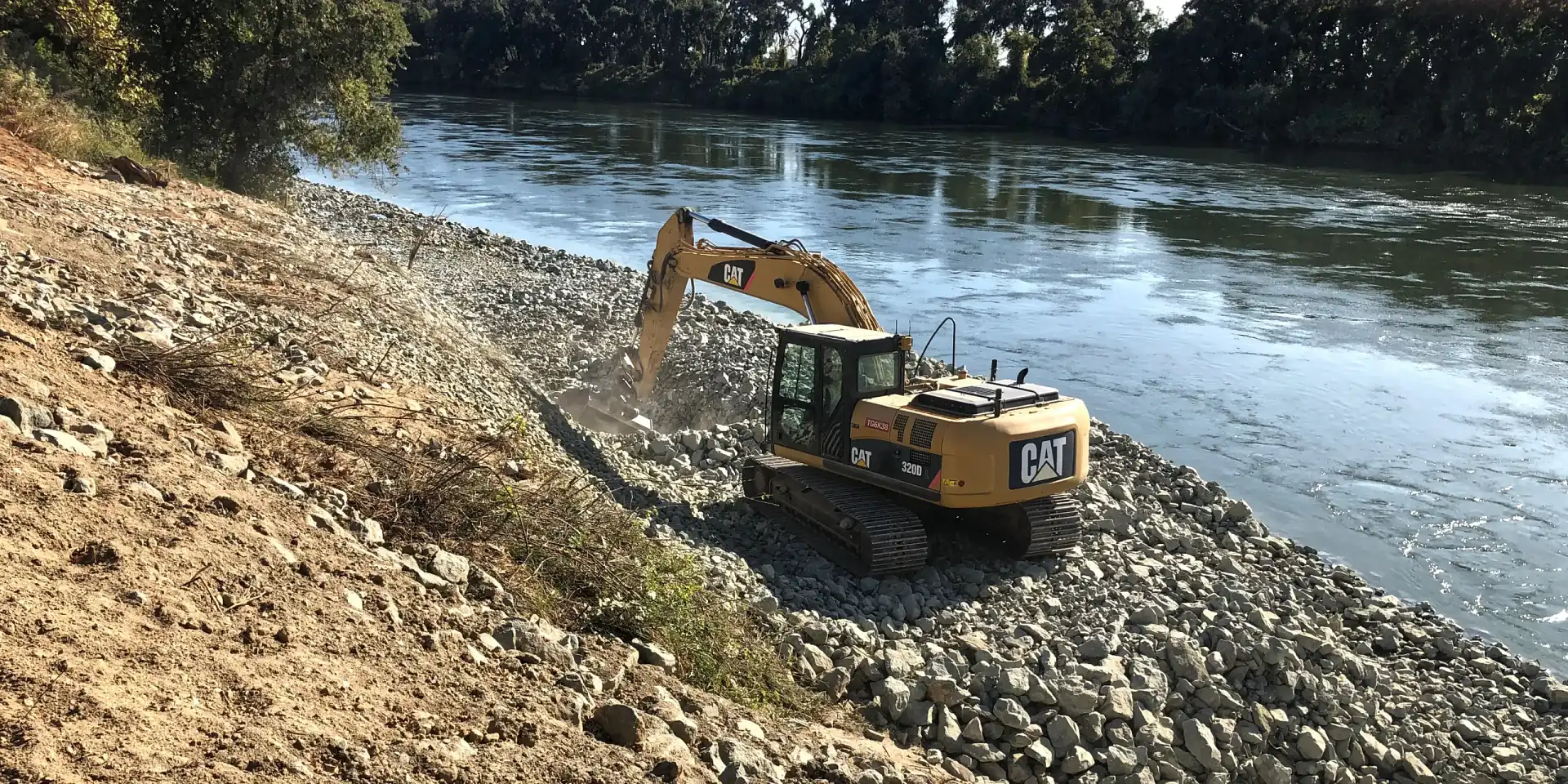
The FHR 1.0L Bank Protection Project is a vital flood infrastructure improvement implemented by the U.S. Army Corps of Engineers (USACE) in Glenn County, California. Located near the city of Willows on the left bank of the Feather River, the project was part of the Sacramento River Flood Control Project (SRFCP), aiming to stabilize over 1,000 linear feet of rapidly eroding riverbank. The work was performed by Fisher Excavating under Contract No. W9123819C0025 and focused on preventing levee failure, safeguarding rural communities, agricultural lands, and critical infrastructure. The reinforced bank now ensures long-term resilience during high-flow events and strengthens the regional flood control system.
This multi-benefit project exemplifies a new model of flood risk reduction that balances structural protection with ecological restoration. In addition to engineered rock slope protection (RSP), the design included native willow plantings, vegetated benches, and in-stream large woody material to support aquatic species. The team ensured full compliance with CEQA, NEPA, and the Endangered Species Act while minimizing impacts to fish migration and water quality. Completed in 2020, the project transitioned into long-term monitoring and has been recognized as a model of environmentally sensitive levee stabilization.
Reinforcing the river’s edge—engineered resilience for communities and ecosystems
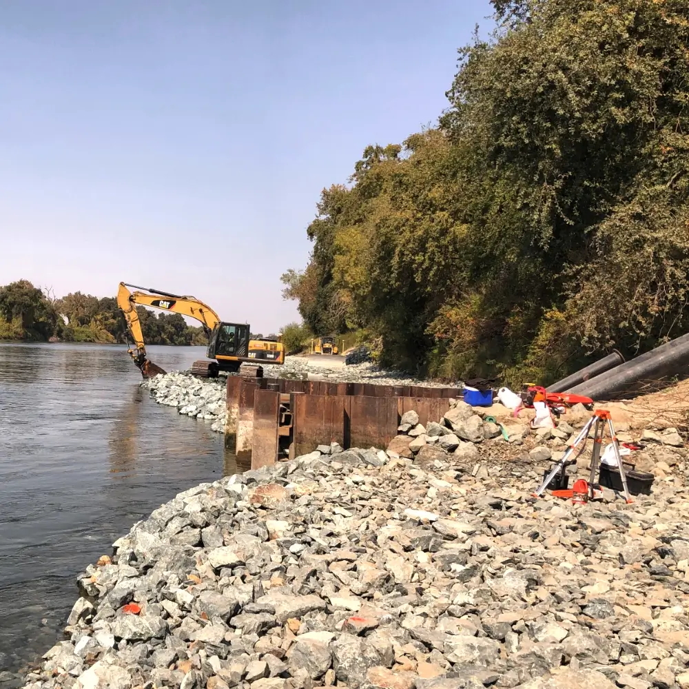
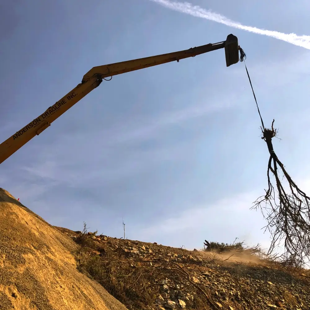
The FHR 1.0L Bank Protection Project advances the Central Valley Flood Protection Plan’s objective of developing multi-benefit flood infrastructure. The strategic intent was to stabilize a high-risk riverbank segment prone to scour and slope failure during high flows, with critical implications for downstream levee performance. The project aligned federal priorities with state environmental mandates by integrating habitat features and hydraulic function. This forward-thinking approach balances flood protection with fish passage, erosion control, and long-term ecological health. It demonstrates the growing role of nature-based solutions in resilient infrastructure planning.
- Installation of over 1,000 linear feet of engineered rock slope protection (RSP)
- Toe trench excavation and backfilling to reinforce the levee base
- Placement of vegetated benches and native willow plantings for bank stabilization
- Integration of large woody material to enhance aquatic habitat complexity
- Temporary road and staging area construction for material and equipment access
- Full environmental compliance with CEQA, NEPA, and Endangered Species Act
The project site is located on the Feather River’s left bank near Willows in Glenn County, forming part of the federally managed Sacramento River Flood Control System. This area protects critical agricultural zones, levee infrastructure, and rural communities vulnerable to climate-exacerbated flood risks. Hydraulic modeling identified this stretch as erosion-prone and hydrologically unstable. The design responded with a combination of traditional engineering and nature-based restoration to maintain flow conveyance and promote habitat continuity. The river’s active sediment regime and ecological significance shaped construction phasing and habitat design.
- Spring 2019– Contract awarded and final permits secured
- Summer–Fall 2019– Site mobilization, in-water construction, and habitat installations
- Fall 2019– Completion of RSP, toe trench, and slope stabilization
- Early 2020– Final grading, erosion control, and revegetation
- Mid-2020– Project closeout and handoff to monitoring and stewardship teams
- Current Status:Completed and under long-term monitoring
The project was built around a dual-purpose model that integrated structural protection with ecological restoration. Rock revetment was paired with bioengineering treatments such as willow cuttings and riparian vegetation to reinforce bank surfaces while promoting habitat value. Construction was timed to avoid peak fish migration and included sediment control strategies to protect downstream water quality. The project’s solar- and climate-ready philosophy aligns with evolving standards for low-impact, resilient infrastructure. Together, these methods demonstrate innovative approaches to protecting flood infrastructure without sacrificing environmental performance.
The FHR 1.0L project provides critical flood protection for farming communities and infrastructure across Glenn County, reducing risk exposure for residents and agricultural stakeholders. It ensures compliance with FEMA’s National Flood Insurance Program (NFIP) levee certification requirements and improves confidence in regional flood defenses. The ecological components contribute to biodiversity and species recovery while reinforcing California’s vision for climate-ready infrastructure. Local economic benefits included construction employment and long-term stewardship roles. The project also serves as a demonstration site for future integrated floodplain management efforts in the Sacramento Valley.
Connect with an ACE Quality Control Project Manager to see how our hands-on approach, technical depth, and disciplined oversight set us apart.